| Encyclopedia of Tours and Travel to Assam, featuring information on Fairs & Festivals, Wildlife, Excursion, Adventure and Weather of Assam. |
 |
 |
 |
 |
 |
 |
 |
 |
|
|
Kokrajhar
Kokrajhar
is one of the twenty-three districts of Assam and can be described
as the gateway to the northeastern region of India. Both road and
rail touches this district at Srirampur before they go on to other
districts in Assam and the other northeast states. The district
has a total area of 3,169.22 sq. km. and a total population of 9,30,404
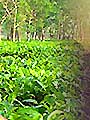
according to the Census-2001. The district can be easily reached as both the mainline road and rail passes through this district. There are beautiful places to visit in the district, especially in the northern side, where the natural scenery is exquisite. There are also numerous natural picnicking spots. It has to be admitted that these places are yet to be developed as tourist spots. But there is a great deal of scope even now for those who are adventurous and willing to witness the glory of nature in all its rugged beauty. The kingdom of Bhutan is intricately linked with the district of Kokrajhar in many vital aspects of life of the people living both in the Bhutan hills and the plains of Kokrajhar. There is hassle-free movement of the people across the international border for the purpose of business and tours. The Bhutanese town of Gelephu is a nice place to visit from Kokrajhar as it is just across the international boundary. There is a fine road leading from the Shyamthaibari point on the National Highway 31(C) to Gelephu. Further on, inside Bhutanese territory, there is the town of Sarbhang that also can be visited via Gelephu. The colourful Bodo community comprises the majority in Kokrajhar district. It also has a sizeable Rajbongshi and Santhal population.
Kokrajhar is also the headquarter of the Bodoland Autonomous Council which was created in 1993. Wildlife The natural habitat of the Golden langur is between the river Sankosh and Manas along the marginal part of the foothills of eastern Himalayas. The extended habitat of this animal is the Chakrasila Wildlife Sanctuary near Kokrajhar. The Golden langur is now endemic to the above habitat and is a critically endangered species. It is also included in the Schedule-I of the Wildlife Protection Act.
|
||||||||||
|
||||||||||
| 2021 Copyrights | bharatheritage.in |