Dumka
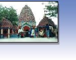
The district of Dumka , in antiquity known as 'Damin-e-ko' was
basically formed into an administrative district by the Britishers
to contain the warring Pahadiyas and the local Ghatwal kings. In
this process the Santhal Tribes were allowed to infiltrate and settle
in large number. After the partition of Bengal, it also played a
major role in the settlement of Bengali population and thus a good
number of Bengali speaking population soon dominated the social
and educational life.
In the next phase with the beginning of transport services and
a bit of business and educational institutions , a good number of
Bhojpuri speaking people made their way to Dumka. Thus the urban
population basically constituted of Bhojpuri and Bengali speaking
people and the rural sectors specially in the interiors remained
dominated by the santhals and the cast backward people. At the same
time , people residing on the hills known as Pahadiyas preferred
to remain outside the main stream. From the administrative point
of view , Dumka become a district way back in 1965 and later on
the divisional head quarter of Santhal Pargana in 1982.Till Dumka
district consisted of Deoghar, Godda, Sahebgunj, Pakur and Jamtara
sub divisions, Dumka remained in the hub of all administrative and
Judicial activities. Thus allowing a good number of floating population.
Excursion
Baba Basukinath Dham
It is situated at Jarmundi Block on Dumka Deoghar State Highway
at a distance of 24 km from the Distrcit Headquarters Dumka. In
whole year lacs and lacs people from different parts of country
come here to worship Lord Shiva. In the month of Shravan people
of several country also come here to worship Lord Shiva.
Mallooti
Mallooti is a historical and religious place which is situated in
Shikaripara Block on Dumka Rampurhat interstate highway at a distance
of 55 km from Dumka District Headquarters. In 1860 Mallooti was
made taxfree capital by the then King Basant Rai alias Basant. This
Mallooti is associated with the archaeological and religious importal
place for natural beauty.
Baba Sumeshwar Nath
It is a religious place which is situated in Saraiyahat Block at
the distance of 60 km from district headquarters Dumka. There is
a big temple of the Lord Shiva. On the eve of Mahashivaratri the
people of different parts of the district come here to worship Lord
Shiva in addition to daily worshiping.
Masanjore Dam
Masanjor dame or the Pearson dame on rever Mayurakshi is a picturesque
place on foot hills of long range of forest clad parallel hill ranges.
This place is basically a hydro electric power generating center
but in the process of time it has become popular center for the
tourist. With the beautiful garden on the down hill and two beautiful
Dak-bunglows on the bank of the river at charm to its beauty.
Tatloie
It is a hot water Spring, situated at a distance of 15 km from the
district headquarters of Dumka. It is rounded by small mounts, beautiful,
attractive and greenish natural atmosphere. The water of spring
is very clear and healthy.
Kathikund
On Dumka-Pakur road , at a distance of around 25 kms. From the main
town there is a block of kathikund. This place with very old establishment
of sericulture and khadi production is surrounded by range hills
and deep forests with a river passing between the valleys. This
topographical background provides numerous sites small and big for
picnic. Some of the important spots in and around the Kathikund
are Nargunj, Saldoha Laprocy mission, Mahuagadhi and Gopikandar.
The site under Gambhara bridge is a fascinating point for outdoor
photography.
Kumdabad
This is a very beautiful picnic spot . Just 13 Kms. from the Dumka
town , you find a rare view of natural beauty with small hills ,beside
that smooth flowing river Mayurakshi.
Hill Range of Dumka
Running south from pakur to godda.The hill range of Dumka seen parallel
& terminate in th Mangalbhanga hill.
To the south east of Dumka is Ramgarh hills ferther west 2parallel
renges of hills also stretch in an easterly direction from Masanjor
to Ranibhal.
Beside hill ranges some hillocks are also in like (i) Lagwa hil
at Nonihat under which lies the Tatloi hot water stream (ii) Hijla
hill top.(iii) Sapchala hill top.(iv) Chuto pahadi.
Maluti (Temple villege on way to Rampurhat).
Hot Springs
Tharia Pani- Near Gopi kandar on Dumka-Pakur Road. max.40km from
Dumka.
Tatloi-Near Barapalasi in BHurbhuri river on Ramgarh hills. mex.25km
from Dumka.
Nunbil max.60km from Dumka-Dumka Jamtara road near Kundhit.
Tapat Pani-Left bank of M. river.1.25miles of Kumrabad.Airodrum
road near Dhadakiya. max.10km from Dumka.
Susum Pani-Close to village baghmara on the opposite bank of Mayurakshi
river.
Top
General Information & Accomdation info on Dumka city of Jharkhand
- India
|