General Information & Accomdation info on Jhunjhunun city of Rajasthan - India   Encyclopedia of Tours and Travel to Rajasthan, featuring information on Fairs & Festivals, Wildlife, Excursion, Adventure and Weather of Rajasthan.
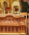
   
Rajasthan


Introduction
Excursion
Wildlife
Fairs & Festival
Adventures & Sports
Traditional Crafts
Shopping
Getting There
Hotels & Accomodation
Weather
Site Map

 
Map of Rajasthan
 
Main Cities

Ajmer
Alwar
Banswara
Baran
Barmer
Bharatpur
Bhilwara
Bikaner
Bundi
Chittaurgarh
Churu
Dausa
Dhaulpur
Dungarpur
Jaipur
Jaisalmer
Jhalawar
Jhunjhunun
Jodhpur
Kota
Nagaur
Pali
Sawai Madhopur
Sikar
Udaipur

Jhunjhunun


The district is situated in the North-Estern part of the State. It is surrounded by Churu on the North-Wesrtern side, Hissar and Mahendragarh of Haryana in the North-Eastern part and by Sika in the West, South and South Eastern Part.

Getting There
By Road
The district is well connected by roads within and outside the State. The total length of gifferent category of roads in the district was about 2,492 km as of March 2000.

By Rail
There are three metre gauge lines passing through the district. The largest rail track passing through the district is Sikar-Luharu line. Total length of this line is 95 kms and is connects important towns of Nawalgarh, Mukundgarh, Jhunjhunun, Chirawa and Surajgarh.

By Air
The nearest Airport is Jaipur (168 kms.)

Distance from major Cities
Jaipur-168 kms.
Delhi-237 kms.
Ahmedabad-793 kms.
Mumbai-1344 kms.

Weather
The average temperature of the area is 22 degree celsius
Rainfall - Normal rainfall is 40.51 cm.

Top    

General Information & Accomdation info on Jhunjhunun city of Rajasthan - India

 
Main Cities
Ajmer | Alwar | Banswara | Baran | Barmer | Bharatpur | Bhilwara | Bikaner | Bundi | Chittaurgarh | Churu | Dausa | Dhaulpur | Dungarpur | Jaipur | Jaisalmer | Jhalawar | Jhunjhunun | Jodhpur | Kota | Nagaur | Pali | Sawai Madhopur | Sikar | Udaipur
 
2021 Copyrights | bharatheritage.in